May 2018
Highways and Waymarkers In the Three Counties from a talk by Jan Sorbie
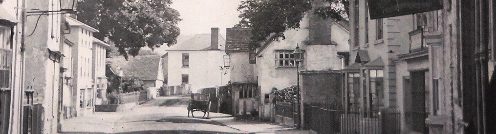
Highways are roads with a legal “right of way” to all, in either direction, as opposed to By ways, and are governed by various Acts of Parliament through history, but from prehistoric times, travel routes across the Country have existed, and constant usage has made them identifiable as such.
The earliest were probably drover’s pathways – as they were well established before the Romans came. It is said that a prominent fir tree was a later indicator of a site ready for a ‘stop over’.
Any frequently used pathway by all and sundry became so worn down, that they were noted as ‘holloways’ – but often happily with a stone verge for pedestrians.
Once settlements were occupied, some sort of trade could begin, and that in salt is very ancient. Saltways usually followed high ground, and were named ‘white ways’, and it could be fair to assume that “white horses” cut into chalk, high on the South Downs, were a form of ‘waymark’ for salters on their way from the Midlands into Wessex. Near here, the saltway crossing the Teme at the Ashfords, ran between hill tops on either side – both labelled “white heads”.
Once the Romans arrived, swift communications were necessary, and as there was now much vehicular traffic, proper ‘built roads’ were laid out, being mainly in straight lines, as that was less expensive than going round and about, and stone paved roadways (streets) were defined by ditches alongside. This profusion meant that markers of some sort had to be provided, which gave rise to ‘milestones’ (mile = 1000 steps), which often gave distances and names for travellers.
As there were 7.400 miles of Roman Roads, milestones must have been plentiful, but as they were of good quality stone, many eventually were found other uses, and only 100 still survive – and if not in a museum – are found at the extremities – like Wales and the North of England.
Maintaining roadways has always been a problem, and at first manors, then later Parishes, were obliged to attempt it – eventually enforced by Parliament in a ‘Statute of Labour’ of 1555, and in 1697, guide posts at crossroads were enforced also. Eventually, the Highways Act of 1835, allowed Local Authorities, and late County Councils to use a Highway Rate to provided more organized and on going upkeep and development.
Turnpikes, to finance busy road upkeep, started to appear after 1700, and they were obliged to provide mileposts with useable information, at first just stone pillars, later cast iron posts with mileages and names of nearby towns, and many have survived until now – supplemented by ‘finger posts’ variously of cast iron, or even just wood, at Road Junctions.
Tolls were collected at Turnpike Cottages, and many of these survive, especially around Kington, and some have even been resited into museums!
Maps with roads started early, the nearest equivalent being the “Antonine Itinery”, of Roman times, from 214 A.D., listing 200 different roads, with the towns and settlements named, and in England, was noted that there were 15 different roads leading out of London into the country, (however not available locally!).
The first proper English map of roads, that survives showing considerable detail and extent, is now 650 years old (rescued by Richard Gough in the 1800s) but was more or less a ‘one off’, as when more maps of Britain were prepared and published in Tudor times – there were lots of towns shown, but noroads – only obstacles to transport noted – i.e. rivers and mountains (and private parkland!), and it was not until the mid 1600s that a proper set of Road maps appeared, as Ogilvie’s “Brittania” of 1675 with separate strips for each main road, with town labels, and nearby connections shown.
So, now there is a plethora of road maps available, but new means of finding your way about on the move exist, possibly the most interesting legacies of earlier times, are the surviving A.A. signs of the early 1900s at the entrance to each town.
JR.
The second of our Summer Visitsis on 30thJune from 3pm when we go Back to School at Goff’s Endowed School, Huntingdon (1791 – 1953), led by Mary Whittall. There will be a Chapel tea afterwards. Booking is again essential : Nancy Wheatland 01544 230691 or Julia Reid 01544 231663. Cost £5, and as parking is limited, car share would be advisable.
Editor: Vera Harrison
